Storms are lining up, the ground is already soaked, and Zimbabwe’s disaster crews just flipped the we are not playing switch.
What triggered the panic mode
What triggered the panic mode
- So yeah, emergency teams across Zimbabwe are officially on high alert.
- The warning came straight from the Meteorological Services Department.
- Heavy rain, wild winds, and thunderstorms are all on deck.
- The Department of Civil Protection kicked response systems into gear.
- National, provincial, and district teams are all activated.
- Money is already flowing from the National Disaster Fund.
- The storm window runs from Tuesday, January 20, to Saturday, January 24, 2026.
- Weather officials say conditions are primed for serious downpours.
- Some spots could see more than 50 millimeters in just one day.
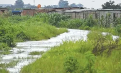
- Weeks of rain already left the soil maxed out.
- The ground cannot soak up much more water.
- That combo makes flash floods hit fast and hard.
- Roads can turn sketchy fast.
- Landslides and rockfalls are a real risk in steep areas.
- Flooding can show up with almost no warning.
- Zimbabwe’s wet season usually runs from mid-November to late March.
- December through February is when rain really stacks up.
- It does not fall evenly; it dumps, then disappears, then dumps again.
- By mid-season, rivers are already swollen.
- Even moderate rain can push things over the edge.
- Low-lying areas and floodplains take the first hit.
- Most seasons wind down by late March.
- Some years push rain into April.
- Late rain after a wet season still causes flooding.
- Floodplains, wetlands, and river basins.
- Urban zones with bad drainage.
- Mountain and hill regions, especially the Eastern Highlands.
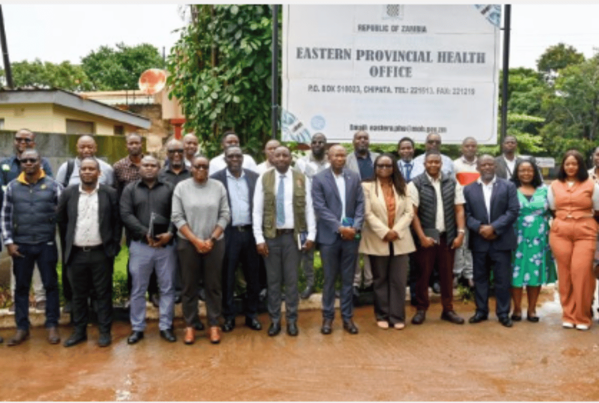
- The Department of Civil Protection says it is fully locked in.
- Nathan Nkomo confirmed funding has been released.
- The National Multi-Hazard Contingency Plan is already in every district.
- Disasters cannot be stopped.
- Damage can be reduced with prep and a fast response.
- Waiting it out is not the plan.
- Rainfall is shaped by global systems like El Niño and La Niña.
- El Niño usually brings drier conditions.
- La Niña tends to crank up rainfall and flood risk.
- Global patterns are only part of the picture.
- Local weather systems and soil conditions matter too.
- That uncertainty is why officials want constant readiness.
- Get indoors immediately when lightning starts.
- Stay away from trees and tall objects.
- Avoid open vehicles and machinery.
- Skip bathing or using taps during storms.
- Never cross flooded rivers, walking or driving.
- Watch for falling trees and roof damage.
- Tie down loose items.
- Check roofs and clear gutters.
- Prep emergency supplies like water, food, torches, and radios.
- Know evacuation routes to higher ground.
- Move livestock away from rivers and low areas.
- Protect stored grain from water.
- Secure equipment.
- Pause field work during storms.
- Some bridges and roads may shut down.
- Power and water cuts are possible.
- Access to services may get patchy during peak rain.
- Stick with official updates from the Meteorological Services Department.
- Follow guidance from the Department of Civil Protection.
- Ignore random rumors flying around.
- Emergency systems are fully active nationwide.
- January 20 to 24 is the danger window.
- Flash flooding is the main threat.
- Following safety advice could save lives.
- Prep needs to happen now, not later.